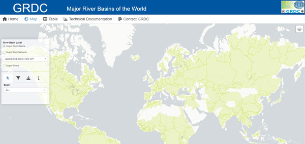
The GRDC Major River Basins is a new web application provided by the Global Runoff Data Centre (GRDC) to present the Major River Basins data product.
The “Major River Basins” and “Major River Networks” layers represent 520 river/lake basins considered “major” in basin size, or in their hydro-political importance or interest. Referring a hydrological determination of a drainage basin by a common outlet to which all waters flow (aka pour point in GIS), Major River Basins may be basins with exorheic drainage, wherein all waters flow to a common outlet, ultimately into an ocean, but also basins with endorheic drainage, where all waters are collected in sinks or lakes not connected to other basins or the ocean. Core reference for assignment to an ocean is “Limits of Oceans and Seas” (IHO, 1953). The “Major River Basins” and “Major River Networks” layers may be used in many ways for example for visualization of basins or river networks in reports, or overlay with other GIS layers such as of groundwater basins or national borders, or for basin-related interpretations of model results. This service is published as an interactive web application by the German Federal Institute of Hydrology (BfG). Disclaimer, Terms and Conditions of the BfG apply. For details about input data, computational setting and processing workflow, please read the technical documentation. Please cite in your publication the GRDC as the source of the data: GRDC (2020): GRDC Major River Basins. Global Runoff Data Centre. 2nd, rev. ed. Koblenz: Federal Institute of Hydrology (BfG).
Link to application:
Major River Basins of the World
Back to top